
Current Projects:
Comparative Research on Urban Growth in Chinese and U.S. Cities.
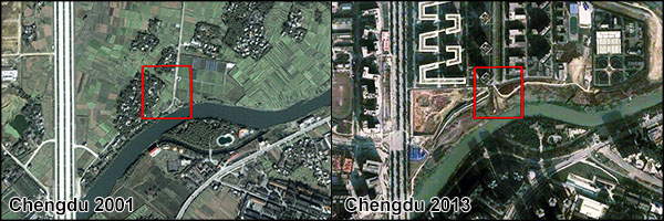
A study of infill and intensification in China and the U.S. presented by Dr. Brian Muller at the 2013 international Association of China Planning Conference in Shanghai, China. Work in Progress.
Previous Personal Research:
Development of Electric Vehicles in China: A Case Study of Kandi Technologies Group Inc.
Spatial Analysis of Kandi Technologies
View Spatial Analysis of Kandi Tech. (KNDI) in a larger map
An observation of the development and operation of a growing electric vehicle company in China. Research includes an inquiry of current issues in Chinese urban transportation, modified public tranportation systems, EV policy, emerging battery technology and a unique car share business model. Research products include spatial analyisis of Kandi's facilities and operations and a series of articles. Read the first article published on the investment web journal Seeking Alpha:Kandi Technologies: Exceptional Strategy for China From an Urban Planning View
The Walkability Indicator: A case study of Boulder, CO
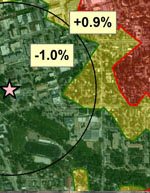
A presentation and paper prepared for the 2013 International Conference on Sustainability in Hiroshima, Japan The walkability indicator is a model developed using data collection and GIS spatial analysis to evaluate the street and neighborhood level walkability of a selected area. The project also includes a discussion on the relationship between walkable design and pedestrian demand.
Conference Presentation
Full Article (In Press)
Adaptability Analysis and Future Development Planning of Xiazhuang Village and Surrounding Area in Chenggong County, Kunming City, Yunnan Province, China
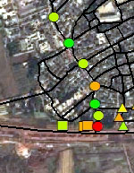
Cooperation with Yunnan Arts University in Kunming, Yunnan Province, China. The project involved travelling to Yunnan Arts University and introducing GIS technology to designers in an urban planning context. YAU Students recieved lectures on basic GIS concepts and skills then were asked to collect data from the neighboring village. The village is currently used as a residential area with a high rural population. The land in the village has been expropriated for the development of new university campuses and other institutional facilities. Students analyzed the existing village and produced design suggestions for the future of the village. This project is ongoing and has involved multiple trips to Yunnan Arts University.
Full PDF
Estimating Recreational OHV Trip Generation Using GIS
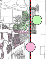
Recreational OHV use has been increasing at a high rate over the last few decades. Due to conflicts associated with recreational OHV, it is helpful for land use planners and open space managers to be able to predict the amount of OHV recreation that is likely to occur within a selected area. The resulting estimate can be used to aid in the development of management plans that limit or decrease the amount of inter-user and environmental conflicts that are associated with OHV use. The following paper provides a GIS methodology to estimate the number of OHV users entering a recreational area at different locations.
Full PDF
City of Boulder Sustainability Indicators Project:
Indicator Project Proposal to the City of Boulder, CO Planning Staff
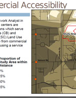
The Land Use Futures Lab at the University of Colorado presented an example of several indicators of sustainability to the City of Boulder Planning Department staff. The indicators were created as they have potential to provide a quantitative performance measure of the effects of the Boulder Valley Comprehensive Plan's components of sustainability.This proposal was to allow the Land Use Futures lab to develop sustainability indicators in a classroom setting and present some suggestions to the planning staff. The intention of the project was to develop a relationship between the University of Colorado and the City of Boulder Planning Department. The students gained access to a civic planning process and allowed the City of Boulder to tap into the students' creativity.
Full Presentation PDF
Urban Heat Metric
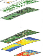
The project intent is to understand how the three urban features: urban form, green infrastructure, and surface materials, influence urban heat. By following the geodesign process and utilizing software such as ArcGIS, relationships between the built environment and urban heat can be conceptualized, modeled and tested. Three goals for the project are:
1 To create an inventory of the built environment by selecting specific features that influence surface heat.
2. To analyze the features inventory and identify areas where existing conditions create abnormally high or low heat.
3. To mitigate urban heat by exploring design strategies that optimize the relationships between features that influence urban heat.
Urban Heat Model
Urban Heat Project Write-Up
Classroom Projects:
Broomfield County Energy Profile
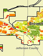
The purpose of this analysis was to create a profile of the production and consumption of electrical energy in Broomfield. The profile includes an investigation of the supply and demand of electricity, policy that influences the economics of electricity, and a projection into the future of electricity in Broomfield County.
Full PDF
Clear Springs Ranch Natural Resource Management Plan
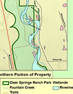
The primary objective of this planning team was to create a plan which describes the variety of human uses occurring on this property, as well as assess the current ecological condition of the property. Once a cumulative assessment was accomplished, the negative effect that human uses impose on the ecology of the park was estimated. The final product of this process was the creation of a plan that suggests future management options aimed at balancing human uses with a healthy park ecosystem.
Full PDF
Urban Morphology in Downtown Denver
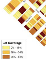
A poster presentation of historic urban form and morphology for an area of six blocks within Denver, CO. Historic imagery and maps were incorporated into GIS to perform a quantitative analysis of the changing urban form since the original settlement in 1893.
Poster PDF
Kootenay National Park Habitat Analysis
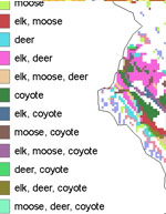
Spatial analyisis of eco-regions, vegetation, and habitat suitability in Kootenay National Park in British Columbia, Canada.
Full PDF
Cost Distance and Cost Path Modeling in Rocky Mountain National Park
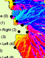
Rocky Mountain National Park is a very popular tourist destination for many people across the nation as well as the globe. It is home to a diverse and extensive trail system which provides access to its thick forests, high altitude plains, and even higher peaks. The broad range of terrain contained within the park system requires a detailed process of modeling and exploring in order to make good a good decision as to where to carve a trail.
Full PDF
Arvada Ridge Station Existing Conditions
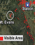
In an effort to better understand the existing conditions of the proposed Arvada Ridge Station and guide future development decisions, my Studio I group compiled this comprehensive report. The purpose of this study is to provide information on the existing conditions found in the area, primarily focusing on: Historical context, environmental conditions, demographic indicators, as well as housing and economic characteristics.
Full PDF